 vesseltracker.com
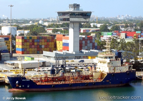
Vessel KORIMAKO IMO: 9557161, MMSI: 512465000 Bunkering Tanker
UTC, -37.66462, 176.18016, course: 188, speed: 0
UTC, -37.66459, 176.18015, course: 188, speed: 0
2026-03-24 21:26:13 UTC, -37.65495, 176.17897, course: 201, speed: 2.1
Live Vessel KORIMAKO Analytics (details, animations, etc.)
Live AIS position: UTC. Near Mount Maunganui), updated 2026-03-24 21:26:13 UTC.Find the position of the vessel KORIMAKO on the map. The latter are known coordinates and path.
marine traffic ship tracker show on live map
The current position of vessel KORIMAKO is -37.65495 lat / 176.17897 lng. Updated: 2026-03-24 21:26:13 UTCCurrently sailing under the flag of New Zealand
KORIMAKO built in 2012 year
Deadweight:
1422 tDetails:
Last coordinates of the vessel:
UTC, -37.64882, 176.18285, course: 169, speed: 0UTC, -37.66462, 176.18016, course: 188, speed: 0
UTC, -37.66459, 176.18015, course: 188, speed: 0
2026-03-24 21:26:13 UTC, -37.65495, 176.17897, course: 201, speed: 2.1