 vesseltracker.com
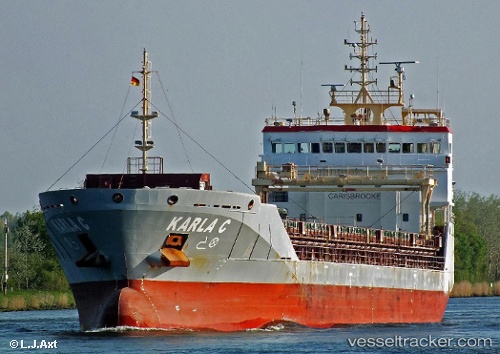
 KARLA C
Current Status
Where is the vessel?
KARLA C is currently in Near Herøya, based on AIS data received about 1h ago.
Latest AIS update:
Current position: 59.11674° N, 9.62373° E (Near Herøya)
Average speed (last 7 days): Loading…
Average speed (last 30 days): Loading…
Vessel profile: KARLA C is a General Cargo Ship with dimensions 106m x 106m.
This page combines live AIS, route history, probable destination signals, nearby traffic, and port activity for practical vessel monitoring.
The current position of vessel KARLA C is 59.11674 lat / 9.62373 lng. Updated: 2026-03-25 21:34:36 UTCNearest reference points:
- Near Rønningen
- Near SANDEFJORD
- Near Thorøya
Currently sailing under the flag of Portugal (MAR) ![]()
KARLA C built in 2010 year
Deadweight:
6795 tDetails:
Live Vessel KARLA C Analytics (details, animations, etc.)
Recent AIS points (UTC):
2026-03-25 15:45:28 UTC · 59.11673, 9.62374 · SOG 0 kn · COG -1°2026-03-25 18:20:49 UTC · 59.11673, 9.62374 · SOG 0 kn · COG 120°
2026-03-25 19:32:47 UTC · 59.11674, 9.62373 · SOG 0 kn · COG 120°
2026-03-25 21:34:36 UTC · 59.11674, 9.62373 · SOG 0 kn · COG -1°