 vesseltracker.com
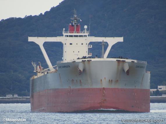
Vessel Cape Sampagita IMO: 9558220, MMSI: 432982000 Bulk Carrier
UTC, -13.41500, 98.43167, course: -1, speed: 11
UTC, -13.08767, 98.72290, course: 40, speed: 11.7
2026-02-17 04:31:48 UTC, -12.74833, 99.03333, course: -1, speed: 11
Live AIS position:
UTC. 133 nm E of Port Refuge),
updated 2026-02-17 04:31:48 UTC.
Find the position of the vessel Cape Sampagita on the map. The latter are known coordinates and path.
marine traffic ship tracker show on live map
The current position of vessel Cape Sampagita is -12.74833 lat / 99.03333 lng. Updated: 2026-02-17 04:31:48 UTCDetails:
Last coordinates of the vessel:
UTC, -13.66500, 98.17833, course: -1, speed: 11UTC, -13.41500, 98.43167, course: -1, speed: 11
UTC, -13.08767, 98.72290, course: 40, speed: 11.7
2026-02-17 04:31:48 UTC, -12.74833, 99.03333, course: -1, speed: 11