 vesseltracker.com
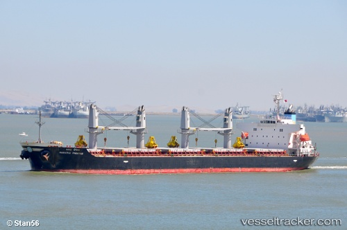
 Maratha Prestige
Current Status
Where is the vessel?
Maratha Prestige is currently in 156 nm SW of Gulfmex Lightering Area, based on AIS data received about 5h ago.
Latest AIS update:
Current position: 26.63832° N, 93.47611° W (156 nm SW of Gulfmex Lightering Area)
Average speed (last 7 days): Loading…
Average speed (last 30 days): Loading…
Vessel profile: Maratha Prestige is a Bulk Carrier with dimensions 175m x 175m.
This page combines live AIS, route history, probable destination signals, nearby traffic, and port activity for practical vessel monitoring.
The current position of vessel Maratha Prestige is 26.63832 lat / -93.47611 lng. Updated: 2026-03-25 12:36:45 UTCNearest reference points:
- 97 nm W of Gulfmex Lightering Area
- 83 nm W of Gulfmex Lightering Area
- 124 nm SW of Gulfmex Lightering Area
Currently sailing under the flag of India ![]()
Maratha Prestige built in 2010 year
Deadweight:
32080 tDetails:
Live Vessel Maratha Prestige Analytics (details, animations, etc.)
Recent AIS points (UTC):
2026-03-25 08:53:04 UTC · 27.23873, -94.00228 · SOG 11.8 kn · COG 146°2026-03-25 09:34:15 UTC · 27.13285, -93.90813 · SOG 12 kn · COG 148°
2026-03-25 12:36:45 UTC · 26.63832, -93.47611 · SOG 13 kn · COG 143°
2026-03-25 12:36:45 UTC · 26.63832, -93.47611 · SOG 13 kn · COG 143°