 vesseltracker.com
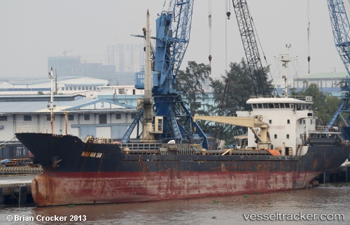
Vessel Hai Ha 58 IMO: 9564102, MMSI: 574000960 Bulk Carrier
UTC, 11.21373, 108.76993, course: 0, speed: 5.1
UTC, 11.21373, 108.76993, course: 0, speed: 5.1
2026-02-13 12:33:05 UTC, 11.21373, 108.76993, course: 0, speed: 5.1
Live AIS position:
UTC. 25 nm SW of Phan Rang-Tháp Chàm),
updated 2026-02-13 12:33:05 UTC.
Find the position of the vessel Hai Ha 58 on the map. The latter are known coordinates and path.
marine traffic ship tracker show on live map
The current position of vessel Hai Ha 58 is 11.21373 lat / 108.76993 lng. Updated: 2026-02-13 12:33:05 UTCDetails:
Last coordinates of the vessel:
UTC, 11.20540, 108.81960, course: 0, speed: 0.4UTC, 11.21373, 108.76993, course: 0, speed: 5.1
UTC, 11.21373, 108.76993, course: 0, speed: 5.1
2026-02-13 12:33:05 UTC, 11.21373, 108.76993, course: 0, speed: 5.1