 vesseltracker.com
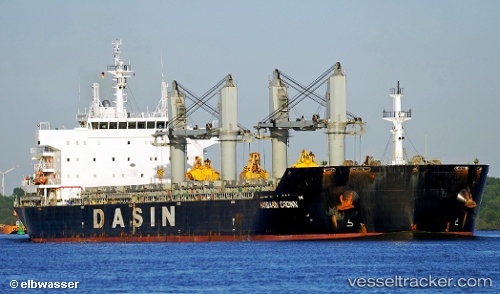
Vessel EASTERN MAGNOLIA IMO: 9569229, MMSI: 636021741 Bulk Carrier
UTC, -3.48051, -38.76334, course: 98, speed: 0.2
UTC, -3.48098, -38.76338, course: 85, speed: 0.2
2026-02-21 15:36:09 UTC, -3.48133, -38.76339, course: 71, speed: 0
Live AIS position:
UTC. Near Pecém Pt/São Gonçalo do Amarante),
updated 2026-02-21 15:36:09 UTC.
Find the position of the vessel EASTERN MAGNOLIA on the map. The latter are known coordinates and path.
marine traffic ship tracker show on live map
The current position of vessel EASTERN MAGNOLIA is -3.48133 lat / -38.76339 lng. Updated: 2026-02-21 15:36:09 UTCCurrently sailing under the flag of Liberia
EASTERN MAGNOLIA built in 2012 year
Deadweight:
56406 tDetails:
Last coordinates of the vessel:
UTC, -3.48064, -38.76339, course: 92, speed: 0UTC, -3.48051, -38.76334, course: 98, speed: 0.2
UTC, -3.48098, -38.76338, course: 85, speed: 0.2
2026-02-21 15:36:09 UTC, -3.48133, -38.76339, course: 71, speed: 0