 vesseltracker.com
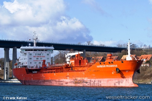
Vessel Harbour Progress IMO: 9572745, MMSI: 255804290 Chemical Oil Products Tanker
UTC, 36.05500, -4.51500, course: -1, speed: 3
UTC, 36.00165, -4.71875, course: 244, speed: 10.5
2026-02-10 10:22:16 UTC, 35.96314, -4.92694, course: 349, speed: 2.1
Live AIS position:
UTC. 19 nm E of Ceuta),
updated 2026-02-10 10:22:16 UTC.
Find the position of the vessel Harbour Progress on the map. The latter are known coordinates and path.
marine traffic ship tracker show on live map
The current position of vessel Harbour Progress is 35.96314 lat / -4.92694 lng. Updated: 2026-02-10 10:22:16 UTCDetails:
Last coordinates of the vessel:
UTC, 36.03167, -4.65167, course: -1, speed: 3UTC, 36.05500, -4.51500, course: -1, speed: 3
UTC, 36.00165, -4.71875, course: 244, speed: 10.5
2026-02-10 10:22:16 UTC, 35.96314, -4.92694, course: 349, speed: 2.1