 vesseltracker.com
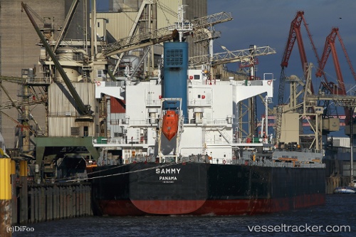
Vessel Sammy IMO: 9582491, MMSI: 373842000 Bulk Carrier
Live AIS position:
UTC. Near Kobe),
updated 2024-06-06 05:11:54 UTC.
Find the position of the vessel Sammy on the map. The latter are known coordinates and path.
marine traffic ship tracker show on live map
The current position of vessel Sammy is 34.66276 lat / 135.20189 lng. Updated: 2024-06-06 05:11:54 UTCCurrently sailing under the flag of Panama
Details:
Last coordinates of the vessel:
2024-06-06 05:11:54 UTC, 34.66276, 135.20189, course: 357, speed: 0