 vesseltracker.com
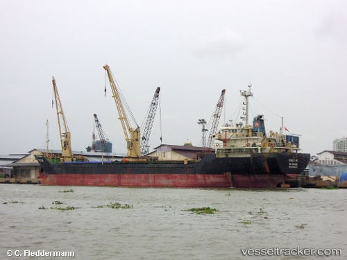
Tien Quang 68
Current StatusWhere is the vessel?
Tien Quang 68 is currently in Near Cua Lo, based on AIS data received about 2h ago.
Latest AIS update:
Current position: 18.85083° N, 105.71135° E (Near Cua Lo)
Average speed (last 7 days): Loading…
Average speed (last 30 days): Loading…
Vessel profile: Tien Quang 68 is a Bulk Carrier with dimensions 16m x 93m.
This page combines live AIS, route history, probable destination signals, nearby traffic, and port activity for practical vessel monitoring.
The current position of vessel Tien Quang 68 is 18.85083 lat / 105.71135 lng. Updated: 2026-03-25 17:24:40 UTCNearest reference points:
- Near Nghi Son
- 60 nm NE of Son Duong Port
- 65 nm W of Basuo Pt
Details:
Live Vessel Tien Quang 68 Analytics (details, animations, etc.)
Recent AIS points (UTC):
2026-03-25 12:18:40 UTC · 18.85087, 105.71133 · SOG 0 kn · COG -1°2026-03-25 14:01:21 UTC · 18.85090, 105.71132 · SOG 0 kn · COG -1°
2026-03-25 15:40:01 UTC · 18.85085, 105.71133 · SOG 0 kn · COG -1°
2026-03-25 17:24:40 UTC · 18.85083, 105.71135 · SOG 0 kn · COG -1°