 vesseltracker.com
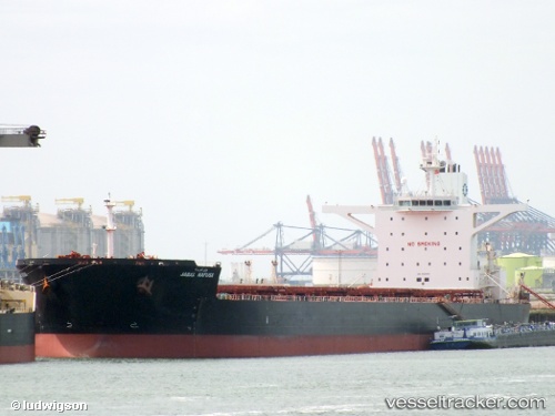
Vessel PANTARISTE IMO: 9589384, MMSI: 636022237 Bulk Carrier
UTC, 26.45148, 119.70851, course: 309, speed: 0.1
UTC, 26.45151, 119.70851, course: 309, speed: 0.1
2026-02-18 00:19:12 UTC, 26.45151, 119.70843, course: 309, speed: 0.1
Live AIS position:
UTC. Near Luoyuanwan),
updated 2026-02-18 00:19:12 UTC.
Find the position of the vessel PANTARISTE on the map. The latter are known coordinates and path.
marine traffic ship tracker show on live map
The current position of vessel PANTARISTE is 26.45151 lat / 119.70843 lng. Updated: 2026-02-18 00:19:12 UTCCurrently sailing under the flag of Liberia
PANTARISTE built in 2011 year
Deadweight:
169097 tDetails:
Last coordinates of the vessel:
UTC, 26.45149, 119.70852, course: 309, speed: 0.1UTC, 26.45148, 119.70851, course: 309, speed: 0.1
UTC, 26.45151, 119.70851, course: 309, speed: 0.1
2026-02-18 00:19:12 UTC, 26.45151, 119.70843, course: 309, speed: 0.1