 vesseltracker.com
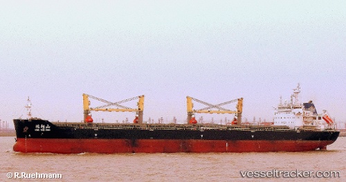
Vessel Hong Yang Shan IMO: 9592757, MMSI: 414006000 Bulk Carrier
UTC, 31.37467, 122.46302, course: 7, speed: 0.1
UTC, 31.37462, 122.46400, course: 1, speed: 0
2026-02-27 05:39:51 UTC, 31.37430, 122.46408, course: 0, speed: 0.3
Live AIS position:
UTC. 19 nm N of Jingjiang),
updated 2026-02-27 05:39:51 UTC.
Find the position of the vessel Hong Yang Shan on the map. The latter are known coordinates and path.
marine traffic ship tracker show on live map
The current position of vessel Hong Yang Shan is 31.37430 lat / 122.46408 lng. Updated: 2026-02-27 05:39:51 UTCCurrently sailing under the flag of China
Details:
Last coordinates of the vessel:
UTC, 31.38307, 122.46345, course: 174, speed: 3.5UTC, 31.37467, 122.46302, course: 7, speed: 0.1
UTC, 31.37462, 122.46400, course: 1, speed: 0
2026-02-27 05:39:51 UTC, 31.37430, 122.46408, course: 0, speed: 0.3