 vesseltracker.com
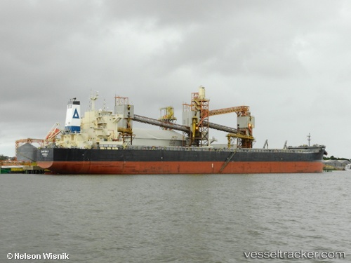
 Chryssa K
Current Status
Where is the vessel?
Chryssa K is currently in 87 nm E of Wenling Longmen Port, based on AIS data received less than 1h ago.
Latest AIS update:
Current position: 28.89010° N, 123.55036° E (87 nm E of Wenling Longmen Port)
Average speed (last 7 days): Loading…
Average speed (last 30 days): Loading…
Vessel profile: Chryssa K is a Bulk Carrier with dimensions 229m x 32m.
This page combines live AIS, route history, probable destination signals, nearby traffic, and port activity for practical vessel monitoring.
The current position of vessel Chryssa K is 28.89010 lat / 123.55036 lng. Updated: 2026-04-22 03:45:08 UTCNearest reference points:
- 107 nm E of Wenling Longmen Port
- 102 nm E of Wenling Longmen Port
- 77 nm SE of ZHOUSHAN
Currently sailing under the flag of Liberia ![]()
Chryssa K built in 2012 year
Deadweight:
81305 tDetails:
Live Vessel Chryssa K Analytics (details, animations, etc.)
Recent AIS points (UTC):
2026-04-22 00:17:04 UTC · 28.34499, 123.18487 · SOG 10.2 kn · COG -1°2026-04-22 01:47:56 UTC · 28.56808, 123.34715 · SOG 11 kn · COG 32°
2026-04-22 01:47:56 UTC · 28.56808, 123.34715 · SOG 11 kn · COG 32°
2026-04-22 03:45:08 UTC · 28.89010, 123.55036 · SOG 11.4 kn · COG 28°