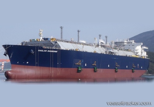
.
Vessel photo of Gaslog Shanghai (IMO 9600528) vesseltracker.com

BM flag Gaslog Shanghai

Vessel type: Lng Tanker | IMO: 9600528 | MMSI: MMSI: 310644000
Call sign: ZCEH4 | Dimensions: 285 m x 285 m
Current Status

Where is the vessel?

Gaslog Shanghai is currently in 109 nm SW of Lüderitz, based on AIS data received about 1h ago.

Latest AIS update:

Current position: 28.10805° S, 13.93941° E (109 nm SW of Lüderitz)

Average speed (last 7 days): Loading…

Average speed (last 30 days): Loading…

Vessel profile: Gaslog Shanghai is a Lng Tanker with dimensions 285m x 285m.

This page combines live AIS, route history, probable destination signals, nearby traffic, and port activity for practical vessel monitoring.

The current position of vessel Gaslog Shanghai is -28.10805 lat / 13.93941 lng. Updated: 2026-03-25 21:41:22 UTC
Nearest reference points:
  • 161 nm W of Koiingnaas
  • Near Luderitz Bay

Currently sailing under the flag of Bermuda BM flag

Details:

Live Vessel Gaslog Shanghai Analytics (details, animations, etc.)


Recent AIS points (UTC):
2026-03-25 15:50:41 UTC · -28.84125, 14.21146 · SOG 7.7 kn · COG 341°
2026-03-25 18:20:00 UTC · -28.52824, 14.09214 · SOG 7.9 kn · COG 340°
2026-03-25 19:32:41 UTC · -28.37274, 14.04011 · SOG 7.9 kn · COG 343°
2026-03-25 21:41:22 UTC · -28.10805, 13.93941 · SOG 8 kn · COG 347°

Track of the vessel in the last 28 days


UTC: --
Start: -- Track timeline (UTC) End: --
Encountered: --


Link to the map:


Find another ship

Gaslog_Shanghai (310644000) last ports (portcalls and passsages)

BATU AMPAR | 2025-08-22 16:20:25
BUKOM ISLAND | 2025-08-21 16:06:58
PULAU SAMBU | 2025-08-21 14:40:06
TANAH MERAH | 2025-08-21 13:34:35
PENGERANG | 2025-08-21 12:22:27
PYEONGTAEK | 2025-08-09 06:59:20
Trincomalee | 2025-07-01 10:14:50
Trincomalee | 2025-06-27 02:51:05
RAS LAFFAN | 2025-06-04 23:12:57
BUKOM ISLAND | 2025-03-26 10:17:04
BATU AMPAR | 2025-03-26 09:16:34
PENGERANG | 2025-03-26 07:50:00
ONSAN | 2025-03-01 00:58:55
BORYEONG | 2025-02-02 02:34:16
DAECHEONHANG | 2025-02-02 01:50:00
Dampier | 2025-01-21 05:25:23
PENGERANG | 2024-12-28 11:11:21
BUKOM ISLAND | 2024-12-27 09:28:02
BATU AMPAR | 2024-12-27 07:41:42
TANAH MERAH | 2024-12-27 07:10:13
BUKOM ISLAND | 2024-11-27 04:08:08
BATU AMPAR | 2024-11-27 02:54:32
PENGERANG | 2024-11-27 01:25:23
Selat Lombok | 2024-11-14 16:13:07
Yokohama | 2024-09-26 00:27:41
Kawasaki | 2024-09-25 23:58:41
Selat Lombok | 2024-07-12 20:40:35
Dampier | 2024-06-25 03:29:46
Map Ta Phut | 2024-06-14 22:41:29
Dampier | 2024-06-04 01:05:02
Selat Lombok | 2024-05-29 18:50:04
Singapore | 2024-05-25 05:45:11
Map Ta Phut | 2024-05-22 02:08:53
Selat Lombok | 2024-05-10 02:43:46
Dampier | 2024-05-07 03:09:21
Yokohama | 2024-04-25 00:00:03
Yokosuka | 2024-04-24 22:58:26
Tso-Ying | 2024-03-29 04:26:01
Dampier | 2024-02-08 00:03:06
Yokohama | 2024-01-26 03:58:12
Dampier | 2024-01-13 23:50:13
Dampier | 2023-12-20 00:21:06
Dampier | 2023-11-16 00:09:50
Singapore | 2023-10-21 03:19:32
Dampier | 2023-09-30 01:05:07
Yokosuka | 2023-09-18 12:07:25
Chibai | 2023-09-17 06:23:04
Kawasaki | 2023-09-17 04:53:26
Dampier | 2023-09-03 01:15:23
Tai-tung Kang | 2023-08-16 23:32:23
Selat Lombok | 2023-07-29 05:31:31
Map Ta Phut | 2023-07-22 23:34:24
Dampier | 2023-07-15 06:33:49
Tai-tung Kang | 2023-05-26 22:15:01
Selat Lombok | 2023-05-20 18:01:43
Yosu | 2023-05-02 23:37:26
Dampier | 2023-04-22 08:31:33
Oita | 2023-04-04 01:56:12
Gladstone Harbor | 2022-12-18 23:44:17
Ras Gharib | 2022-11-12 23:07:08
Port Said | 2022-11-12 05:32:57
Ceuta | 2022-11-06 08:42:11
Bur Ibrahim | 2022-10-06 04:44:01
Ra’S Shukhayr | 2022-10-05 01:40:13
Yosu | 2022-08-20 22:12:07
Valparaiso | 2022-02-20 16:10:41
Strait Of Gibraltar | 2022-01-13 05:40:38
Port Said | 2022-01-01 15:38:15
Bur Ibrahim | 2022-01-01 05:40:05
Singapore | 2021-12-13 03:35:55