 vesseltracker.com
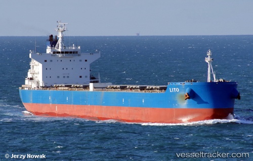
Vessel Lito IMO: 9601338, MMSI: 636015548 Bulk Carrier
UTC, -35.19788, -55.53478, course: 209, speed: 0.3
UTC, -35.19788, -55.53478, course: 209, speed: 0.3
2026-03-23 22:58:09 UTC, -35.19788, -55.53478, course: 209, speed: 0.3
Live Vessel Lito Analytics (details, animations, etc.)
Live AIS position: UTC. 24 nm SW of Piriápolis), updated 2026-03-23 22:58:09 UTC.Find the position of the vessel Lito on the map. The latter are known coordinates and path.
marine traffic ship tracker show on live map
The current position of vessel Lito is -35.19788 lat / -55.53478 lng. Updated: 2026-03-23 22:58:09 UTCDetails:
Last coordinates of the vessel:
UTC, -35.19950, -55.53381, course: -1, speed: 0.2UTC, -35.19788, -55.53478, course: 209, speed: 0.3
UTC, -35.19788, -55.53478, course: 209, speed: 0.3
2026-03-23 22:58:09 UTC, -35.19788, -55.53478, course: 209, speed: 0.3