 vesseltracker.com
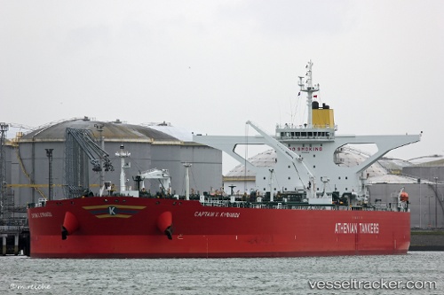
Vessel CAPTAIN X KYRIAKOU IMO: 9602928, MMSI: 636020559 Crude Oil Tanker
UTC, 25.36253, 53.15489, course: 63, speed: 5.1
UTC, 25.44230, 53.27423, course: 52, speed: 5.2
2026-02-25 05:54:26 UTC, 25.76940, 53.33035, course: 7, speed: 10.3
Live AIS position:
UTC. 20 nm NW of Mirfa),
updated 2026-02-25 05:54:26 UTC.
Find the position of the vessel CAPTAIN X KYRIAKOU on the map. The latter are known coordinates and path.
marine traffic ship tracker show on live map
The current position of vessel CAPTAIN X KYRIAKOU is 25.76940 lat / 53.33035 lng. Updated: 2026-02-25 05:54:26 UTCCurrently sailing under the flag of Liberia
CAPTAIN X KYRIAKOU built in 2013 year
Deadweight:
299991 tDetails:
Last coordinates of the vessel:
UTC, 25.22369, 52.96813, course: 52, speed: 7.7UTC, 25.36253, 53.15489, course: 63, speed: 5.1
UTC, 25.44230, 53.27423, course: 52, speed: 5.2
2026-02-25 05:54:26 UTC, 25.76940, 53.33035, course: 7, speed: 10.3