 vesseltracker.com
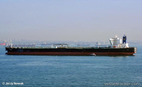
Vessel HE RONG HAI IMO: 9603192, MMSI: 412311000 Tanker B
UTC, 25.94339, 53.39730, course: 203, speed: 0.1
UTC, 25.94393, 53.39524, course: 168, speed: 0.1
2026-03-24 13:49:16 UTC, 25.94295, 53.39266, course: 137, speed: 0.1
Live Vessel HE RONG HAI Analytics (details, animations, etc.)
Live AIS position: UTC. 29 nm N of Mirfa), updated 2026-03-24 13:49:16 UTC.Find the position of the vessel HE RONG HAI on the map. The latter are known coordinates and path.
marine traffic ship tracker show on live map
The current position of vessel HE RONG HAI is 25.94295 lat / 53.39266 lng. Updated: 2026-03-24 13:49:16 UTCCurrently sailing under the flag of China
Details:
Last coordinates of the vessel:
UTC, 25.94325, 53.39588, course: 194, speed: 0.1UTC, 25.94339, 53.39730, course: 203, speed: 0.1
UTC, 25.94393, 53.39524, course: 168, speed: 0.1
2026-03-24 13:49:16 UTC, 25.94295, 53.39266, course: 137, speed: 0.1