 vesseltracker.com
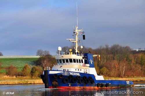
Vessel Norne IMO: 9612806, MMSI: 245460000 Tug
UTC, 36.13282, -5.41824, course: 177, speed: 0.2
UTC, 36.13281, -5.41826, course: 177, speed: 0.1
2026-02-14 03:35:22 UTC, 36.13280, -5.41824, course: 177, speed: 0.1
Live AIS position:
UTC. Near Algeciras),
updated 2026-02-14 03:35:22 UTC.
Find the position of the vessel Norne on the map. The latter are known coordinates and path.
marine traffic ship tracker show on live map
The current position of vessel Norne is 36.13280 lat / -5.41824 lng. Updated: 2026-02-14 03:35:22 UTCCurrently sailing under the flag of Netherlands
Norne built in 2011 year
Deadweight:
580 tDetails:
Last coordinates of the vessel:
UTC, 36.13281, -5.41824, course: 177, speed: 0UTC, 36.13282, -5.41824, course: 177, speed: 0.2
UTC, 36.13281, -5.41826, course: 177, speed: 0.1
2026-02-14 03:35:22 UTC, 36.13280, -5.41824, course: 177, speed: 0.1