 vesseltracker.com
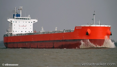
 Seabiscuit
Current Status
Where is the vessel?
Seabiscuit is currently in 105 nm SW of Harriet Harbour, based on AIS data received about 1h ago.
Latest AIS update:
Current position: 50.74805° N, 132.67052° W (105 nm SW of Harriet Harbour)
Average speed (last 7 days): Loading…
Average speed (last 30 days): Loading…
Vessel profile: Seabiscuit is a Bulk Carrier with dimensions 229m x 32m.
This page combines live AIS, route history, probable destination signals, nearby traffic, and port activity for practical vessel monitoring.
The current position of vessel Seabiscuit is 50.74805 lat / -132.67052 lng. Updated: 2026-03-25 18:01:31 UTCNearest reference points:
- Near Queen Charlotte
Currently sailing under the flag of Panama ![]()
Details:
Live Vessel Seabiscuit Analytics (details, animations, etc.)
Recent AIS points (UTC):
2026-03-25 11:38:36 UTC · 51.24244, -134.81619 · SOG 13.7 kn · COG 109°2026-03-25 13:51:44 UTC · 51.06603, -134.07384 · SOG 13.8 kn · COG 109°
2026-03-25 15:54:58 UTC · 50.90467, -133.36438 · SOG 13.8 kn · COG 107°
2026-03-25 18:01:31 UTC · 50.74805, -132.67052 · SOG 13.3 kn · COG 105°