 vesseltracker.com
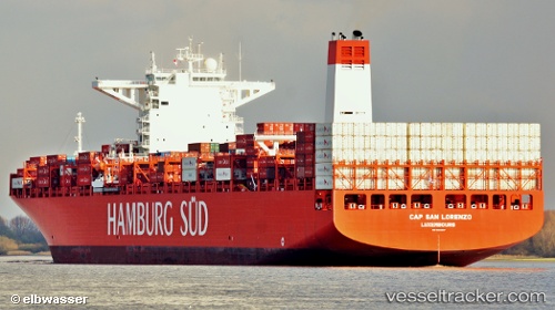
 Cap San Lorenzo
Current Status
Where is the vessel?
Cap San Lorenzo is currently in 183 nm NE of Port Mathurin, based on AIS data received about 1h ago.
Latest AIS update:
Current position: 16.90186° S, 64.75064° E (183 nm NE of Port Mathurin)
Average speed (last 7 days): Loading…
Average speed (last 30 days): Loading…
Vessel profile: Cap San Lorenzo is a Container Ship with dimensions 333m x 48m.
This page combines live AIS, route history, probable destination signals, nearby traffic, and port activity for practical vessel monitoring.
The current position of vessel Cap San Lorenzo is -16.90186 lat / 64.75064 lng. Updated: 2026-03-26 03:39:40 UTCNearest reference points:
- 154 nm NE of Port Mathurin
- 241 nm N of Port Mathurin
Currently sailing under the flag of Denmark ![]()
Cap San Lorenzo built in 2013 year
Deadweight:
124479 tDetails:
Live Vessel Cap San Lorenzo Analytics (details, animations, etc.)
Recent AIS points (UTC):
2026-03-25 22:15:59 UTC · -17.66833, 63.61667 · SOG 14 kn · COG -1°2026-03-25 23:45:59 UTC · -17.44667, 63.92833 · SOG 14 kn · COG -1°
2026-03-26 01:23:51 UTC · -17.20934, 64.27179 · SOG 14.9 kn · COG 58°
2026-03-26 03:39:40 UTC · -16.90186, 64.75064 · SOG 14.9 kn · COG 59°