 vesseltracker.com
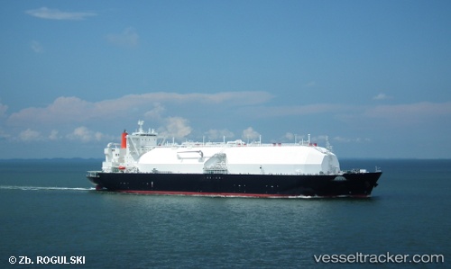
Vessel Lng Mars IMO: 9645748, MMSI: 431177000 Lng Tanker
UTC, -6.87180, 126.92928, course: 163, speed: 10.7
UTC, -7.21077, 127.01909, course: 168, speed: 11.1
2026-03-24 15:28:58 UTC, -7.59723, 127.12827, course: 150, speed: 10.2
Live Vessel Lng Mars Analytics (details, animations, etc.)
Live AIS position: UTC. 47 nm NW of Selat Wetar), updated 2026-03-24 15:28:58 UTC.Find the position of the vessel Lng Mars on the map. The latter are known coordinates and path.
marine traffic ship tracker show on live map
The current position of vessel Lng Mars is -7.59723 lat / 127.12827 lng. Updated: 2026-03-24 15:28:58 UTCCurrently sailing under the flag of Japan
Details:
Last coordinates of the vessel:
UTC, -6.57066, 126.85360, course: 164, speed: 11.1UTC, -6.87180, 126.92928, course: 163, speed: 10.7
UTC, -7.21077, 127.01909, course: 168, speed: 11.1
2026-03-24 15:28:58 UTC, -7.59723, 127.12827, course: 150, speed: 10.2