 vesseltracker.com
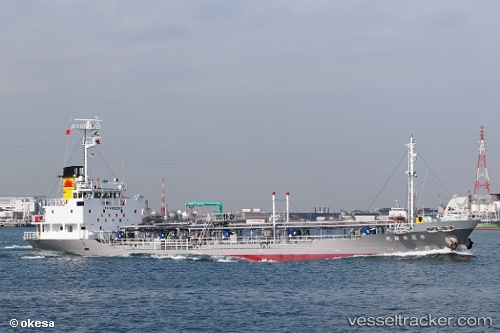
Vessel Wayo Maru IMO: 9652313, MMSI: 431003911 Oil Products Tanker
UTC, 34.05044, 132.84428, course: 37, speed: 0.1
UTC, 34.05044, 132.84428, course: 37, speed: 0.1
2026-03-11 13:55:17 UTC, 34.05130, 132.84521, course: 188, speed: 0
Live Vessel Wayo Maru Analytics (details, animations, etc.)
Live AIS position: UTC. Near KIKUMA), updated 2026-03-11 13:55:17 UTC.Find the position of the vessel Wayo Maru on the map. The latter are known coordinates and path.
marine traffic ship tracker show on live map
The current position of vessel Wayo Maru is 34.05130 lat / 132.84521 lng. Updated: 2026-03-11 13:55:17 UTCDetails:
Last coordinates of the vessel:
UTC, 34.05075, 132.84401, course: 73, speed: 0.1UTC, 34.05044, 132.84428, course: 37, speed: 0.1
UTC, 34.05044, 132.84428, course: 37, speed: 0.1
2026-03-11 13:55:17 UTC, 34.05130, 132.84521, course: 188, speed: 0