 vesseltracker.com
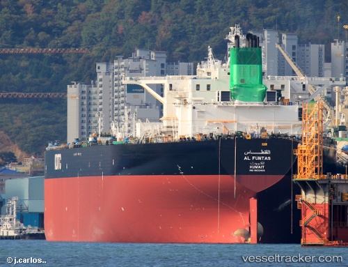
Vessel Al Funtas IMO: 9653408, MMSI: 447184000 Crude Oil Tanker
UTC, 35.35419, 121.75220, course: 70, speed: 13.6
UTC, 35.40643, 121.91055, course: 50, speed: 0.2
2026-02-16 15:38:45 UTC, 35.40662, 121.91042, course: 54, speed: 0.1
Live AIS position:
UTC. 78 nm SE of Nudao),
updated 2026-02-16 15:38:45 UTC.
Find the position of the vessel Al Funtas on the map. The latter are known coordinates and path.
marine traffic ship tracker show on live map
The current position of vessel Al Funtas is 35.40662 lat / 121.91042 lng. Updated: 2026-02-16 15:38:45 UTCDetails:
Last coordinates of the vessel:
UTC, 35.18567, 121.01240, course: 69, speed: 14.7UTC, 35.35419, 121.75220, course: 70, speed: 13.6
UTC, 35.40643, 121.91055, course: 50, speed: 0.2
2026-02-16 15:38:45 UTC, 35.40662, 121.91042, course: 54, speed: 0.1