 vesseltracker.com
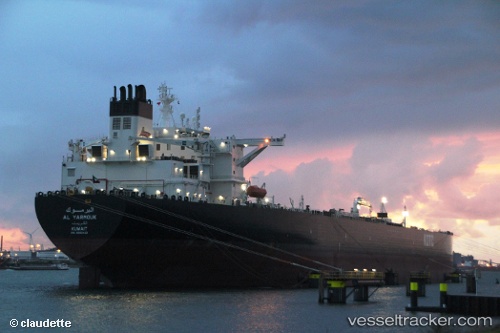
Vessel Al Yarmouk IMO: 9653422, MMSI: 447188000 Crude Oil Tanker
UTC, 28.99908, 48.49912, course: 322, speed: 0
UTC, 28.99918, 48.49903, course: 321, speed: 0
2026-03-24 18:16:54 UTC, 29.00138, 48.49918, course: 247, speed: 0.2
Live Vessel Al Yarmouk Analytics (details, animations, etc.)
Live AIS position: UTC. 16 nm E of Mina Abd Allah), updated 2026-03-24 18:16:54 UTC.Find the position of the vessel Al Yarmouk on the map. The latter are known coordinates and path.
marine traffic ship tracker show on live map
The current position of vessel Al Yarmouk is 29.00138 lat / 48.49918 lng. Updated: 2026-03-24 18:16:54 UTCDetails:
Last coordinates of the vessel:
UTC, 28.99912, 48.49405, course: 61, speed: 0.4UTC, 28.99908, 48.49912, course: 322, speed: 0
UTC, 28.99918, 48.49903, course: 321, speed: 0
2026-03-24 18:16:54 UTC, 29.00138, 48.49918, course: 247, speed: 0.2