 vesseltracker.com
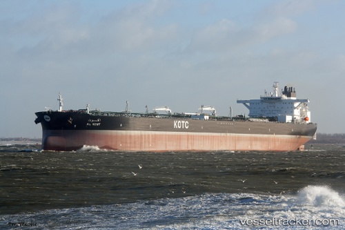
Vessel Al Kout IMO: 9653434, MMSI: 447189000 Crude Oil Tanker
UTC, 9.34363, 74.85808, course: 321, speed: 13.2
UTC, 9.68687, 74.69802, course: 331, speed: 13.3
2026-02-16 20:24:20 UTC, 10.18385, 74.42577, course: 338, speed: 13.5
Live AIS position:
UTC. 47 nm E of Kalpeni Island),
updated 2026-02-16 20:24:20 UTC.
Find the position of the vessel Al Kout on the map. The latter are known coordinates and path.
marine traffic ship tracker show on live map
The current position of vessel Al Kout is 10.18385 lat / 74.42577 lng. Updated: 2026-02-16 20:24:20 UTCCurrently sailing under the flag of Kuwait
Details:
Last coordinates of the vessel:
UTC, 8.98613, 75.30937, course: 307, speed: 14UTC, 9.34363, 74.85808, course: 321, speed: 13.2
UTC, 9.68687, 74.69802, course: 331, speed: 13.3
2026-02-16 20:24:20 UTC, 10.18385, 74.42577, course: 338, speed: 13.5