 vesseltracker.com
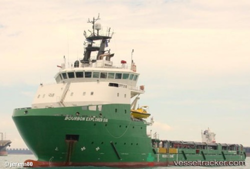
Vessel Bourbon Explorer 516 IMO: 9654311, MMSI: 228075800 Offshore Tug Supply Ship
UTC, -6.32038, 11.05308, course: 199, speed: 0.2
UTC, -6.33877, 11.09292, course: 109, speed: 5.7
2026-02-14 21:34:45 UTC, -6.37363, 11.13430, course: 174, speed: 0.5
Live AIS position:
UTC. Near Saxi Batuque FPSO),
updated 2026-02-14 21:34:45 UTC.
Find the position of the vessel Bourbon Explorer 516 on the map. The latter are known coordinates and path.
marine traffic ship tracker show on live map
The current position of vessel Bourbon Explorer 516 is -6.37363 lat / 11.13430 lng. Updated: 2026-02-14 21:34:45 UTCCurrently sailing under the flag of France
Details:
Last coordinates of the vessel:
UTC, -6.32041, 11.05330, course: 199, speed: 0.1UTC, -6.32038, 11.05308, course: 199, speed: 0.2
UTC, -6.33877, 11.09292, course: 109, speed: 5.7
2026-02-14 21:34:45 UTC, -6.37363, 11.13430, course: 174, speed: 0.5