 vesseltracker.com
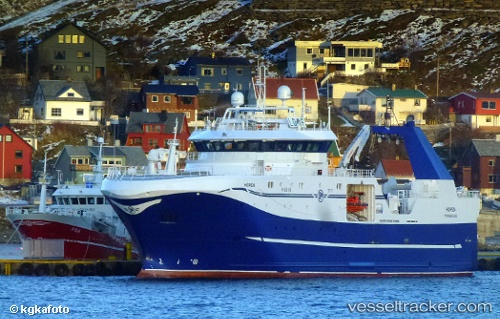
Vessel Remoy IMO: 9660451, MMSI: 258984000 Fishing Vessel
UTC, 76.19688, 37.98444, course: 4, speed: 2.1
UTC, 76.27362, 37.93386, course: 165, speed: 1.6
2026-02-24 21:35:57 UTC, 76.22614, 37.93681, course: 171, speed: 2.3
Live AIS position:
UTC. 181 nm E of Hopen),
updated 2026-02-24 21:35:57 UTC.
Find the position of the vessel Remoy on the map. The latter are known coordinates and path.
marine traffic ship tracker show on live map
The current position of vessel Remoy is 76.22614 lat / 37.93681 lng. Updated: 2026-02-24 21:35:57 UTCDetails:
Last coordinates of the vessel:
UTC, 76.12338, 37.99074, course: 38, speed: 3.5UTC, 76.19688, 37.98444, course: 4, speed: 2.1
UTC, 76.27362, 37.93386, course: 165, speed: 1.6
2026-02-24 21:35:57 UTC, 76.22614, 37.93681, course: 171, speed: 2.3