 vesseltracker.com
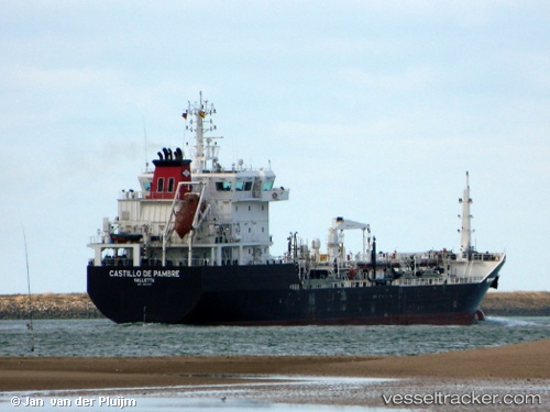
Vessel Castillo De Pambre IMO: 9661857, MMSI: 229412000 Bitumen Tanker
UTC, 36.17708, -5.40024, course: 83, speed: 0
UTC, 36.17708, -5.40024, course: 83, speed: 0.1
2026-02-16 09:28:35 UTC, 36.17707, -5.40026, course: 83, speed: 0.1
Live AIS position:
UTC. Near CARTEYA GUADARRANQUE),
updated 2026-02-16 09:28:35 UTC.
Find the position of the vessel Castillo De Pambre on the map. The latter are known coordinates and path.
marine traffic ship tracker show on live map
The current position of vessel Castillo De Pambre is 36.17707 lat / -5.40026 lng. Updated: 2026-02-16 09:28:35 UTCCurrently sailing under the flag of Malta
Castillo De Pambre built in 2013 year
Deadweight:
8353 tDetails:
Last coordinates of the vessel:
UTC, 36.17708, -5.40025, course: 83, speed: 0UTC, 36.17708, -5.40024, course: 83, speed: 0
UTC, 36.17708, -5.40024, course: 83, speed: 0.1
2026-02-16 09:28:35 UTC, 36.17707, -5.40026, course: 83, speed: 0.1