 vesseltracker.com
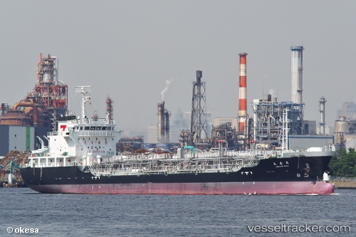
 Kakusei Maru
Current Status
Where is the vessel?
Kakusei Maru is currently in 26 nm N of Niigata, based on AIS data received about 3h ago.
Latest AIS update:
Current position: 38.39500° N, 139.02167° E (26 nm N of Niigata)
Average speed (last 7 days): Loading…
Average speed (last 30 days): Loading…
Vessel profile: Kakusei Maru is a Oil Products Tanker with dimensions 105m x 16m.
This page combines live AIS, route history, probable destination signals, nearby traffic, and port activity for practical vessel monitoring.
The current position of vessel Kakusei Maru is 38.39500 lat / 139.02167 lng. Updated: 2026-03-25 05:44:18 UTCNearest reference points:
- 63 nm NW of Sado Shima Apt
- Near Shiogama
- Near ISHINOMAKI
Currently sailing under the flag of Japan ![]()
Details:
Live Vessel Kakusei Maru Analytics (details, animations, etc.)
Recent AIS points (UTC):
2026-03-24 23:32:17 UTC · 39.61167, 139.63167 · SOG 12 kn · COG -1°2026-03-25 01:14:19 UTC · 39.26167, 139.63499 · SOG 13 kn · COG -1°
2026-03-25 04:20:19 UTC · 38.65667, 139.23666 · SOG 13 kn · COG -1°
2026-03-25 05:44:18 UTC · 38.39500, 139.02167 · SOG 13 kn · COG -1°