 vesseltracker.com
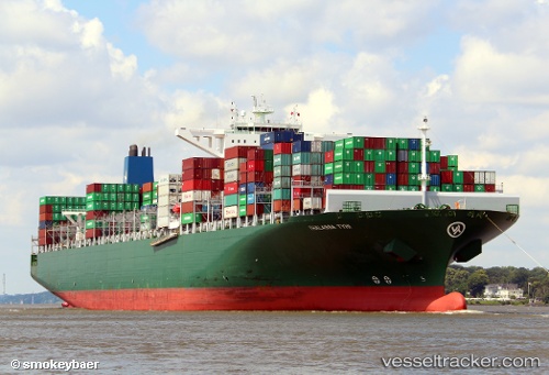
Vessel Thalassa Tyhi IMO: 9667162, MMSI: 636018702 Container Ship
UTC, 18.94752, 72.94029, course: 219, speed: 0
UTC, 18.94753, 72.94028, course: 219, speed: 0
2026-02-13 05:20:39 UTC, 18.94753, 72.94025, course: 219, speed: 0
Live AIS position:
UTC. Near NHAVA SHEVA),
updated 2026-02-13 05:20:39 UTC.
Find the position of the vessel Thalassa Tyhi on the map. The latter are known coordinates and path.
marine traffic ship tracker show on live map
The current position of vessel Thalassa Tyhi is 18.94753 lat / 72.94025 lng. Updated: 2026-02-13 05:20:39 UTCCurrently sailing under the flag of Liberia
Thalassa Tyhi built in 2014 year
Deadweight:
131862 tDetails:
Last coordinates of the vessel:
UTC, 18.94750, 72.94026, course: 219, speed: 0.1UTC, 18.94752, 72.94029, course: 219, speed: 0
UTC, 18.94753, 72.94028, course: 219, speed: 0
2026-02-13 05:20:39 UTC, 18.94753, 72.94025, course: 219, speed: 0