 vesseltracker.com
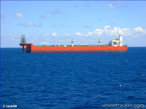
Vessel Gaza Marine Terminal IMO: 9673135, MMSI: 642122040 Fpso Tanker
UTC, 33.90115, 12.66828, course: -1, speed: 0
UTC, 33.90098, 12.66828, course: 80, speed: 0
2026-02-27 17:31:04 UTC, 33.90147, 12.66822, course: -1, speed: 0
Live AIS position:
UTC. 39 nm E of Didon),
updated 2026-02-27 17:31:04 UTC.
Find the position of the vessel Gaza Marine Terminal on the map. The latter are known coordinates and path.
marine traffic ship tracker show on live map
The current position of vessel Gaza Marine Terminal is 33.90147 lat / 12.66822 lng. Updated: 2026-02-27 17:31:04 UTCCurrently sailing under the flag of Libya
Details:
Last coordinates of the vessel:
UTC, 33.90137, 12.66830, course: -1, speed: 0UTC, 33.90115, 12.66828, course: -1, speed: 0
UTC, 33.90098, 12.66828, course: 80, speed: 0
2026-02-27 17:31:04 UTC, 33.90147, 12.66822, course: -1, speed: 0