 vesseltracker.com
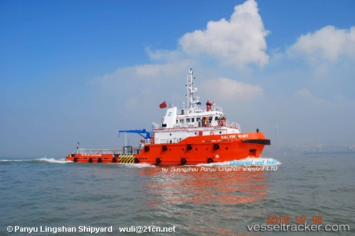
Vessel MASHHOR RUBY IMO: 9676412, MMSI: 508111303 Tug
UTC, 5.13833, 114.73333, course: -1, speed: 0
UTC, 5.13833, 114.73333, course: -1, speed: 0
2026-02-26 15:27:10 UTC, 5.13833, 114.73333, course: -1, speed: 0
Live AIS position:
UTC. 19 nm NW of Bandar Seri Begawan),
updated 2026-02-26 15:27:10 UTC.
Find the position of the vessel MASHHOR RUBY on the map. The latter are known coordinates and path.
marine traffic ship tracker show on live map
The current position of vessel MASHHOR RUBY is 5.13833 lat / 114.73333 lng. Updated: 2026-02-26 15:27:10 UTCCurrently sailing under the flag of Brunei Darussalam
MASHHOR RUBY built in 2012 year
Deadweight:
400 tDetails:
Last coordinates of the vessel:
UTC, 5.14333, 114.73833, course: -1, speed: 0UTC, 5.13833, 114.73333, course: -1, speed: 0
UTC, 5.13833, 114.73333, course: -1, speed: 0
2026-02-26 15:27:10 UTC, 5.13833, 114.73333, course: -1, speed: 0