 vesseltracker.com
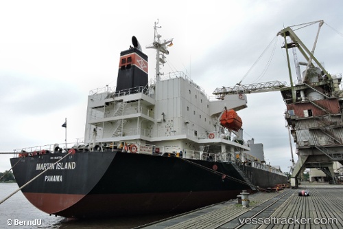
Vessel Martin Island IMO: 9681704, MMSI: 356660000 General Cargo Ship
UTC, 3.57667, 113.18833, course: -1, speed: 0
UTC, 3.57833, 113.18833, course: -1, speed: 0
2026-02-25 03:35:40 UTC, 3.57833, 113.18833, course: -1, speed: 0
Live AIS position:
UTC. Near Samalaju),
updated 2026-02-25 03:35:40 UTC.
Find the position of the vessel Martin Island on the map. The latter are known coordinates and path.
marine traffic ship tracker show on live map
The current position of vessel Martin Island is 3.57833 lat / 113.18833 lng. Updated: 2026-02-25 03:35:40 UTCDetails:
Last coordinates of the vessel:
UTC, 3.57689, 113.18884, course: -1, speed: 0UTC, 3.57667, 113.18833, course: -1, speed: 0
UTC, 3.57833, 113.18833, course: -1, speed: 0
2026-02-25 03:35:40 UTC, 3.57833, 113.18833, course: -1, speed: 0