 vesseltracker.com
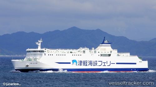
Vessel Blue Mermaid IMO: 9682136, MMSI: 431005263 Passenger Ro Ro Cargo Ship
UTC, 41.80759, 140.70065, course: 295, speed: 11
UTC, 41.30616, 140.64108, course: 166, speed: 18.5
2026-02-09 02:11:34 UTC, 40.84631, 140.71747, course: 56, speed: 0.1
Live AIS position:
UTC. Near Aomori),
updated 2026-02-09 02:11:34 UTC.
Find the position of the vessel Blue Mermaid on the map. The latter are known coordinates and path.
marine traffic ship tracker show on live map
The current position of vessel Blue Mermaid is 40.84631 lat / 140.71747 lng. Updated: 2026-02-09 02:11:34 UTCDetails:
Last coordinates of the vessel:
UTC, 41.75492, 140.66724, course: 10, speed: 17.8UTC, 41.80759, 140.70065, course: 295, speed: 11
UTC, 41.30616, 140.64108, course: 166, speed: 18.5
2026-02-09 02:11:34 UTC, 40.84631, 140.71747, course: 56, speed: 0.1