 vesseltracker.com
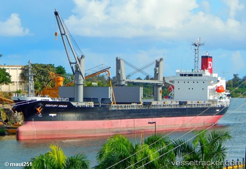
Vessel Century Dream IMO: 9694854, MMSI: 354455000 Bulk Carrier
UTC, 29.89887, -89.91081, course: 348, speed: 0.1
UTC, 29.89871, -89.91074, course: 344, speed: 0
2026-02-22 16:33:22 UTC, 29.89865, -89.91062, course: 340, speed: 0.2
Live AIS position:
UTC. Near Meraux),
updated 2026-02-22 16:33:22 UTC.
Find the position of the vessel Century Dream on the map. The latter are known coordinates and path.
marine traffic ship tracker show on live map
The current position of vessel Century Dream is 29.89865 lat / -89.91062 lng. Updated: 2026-02-22 16:33:22 UTCCurrently sailing under the flag of Panama
Details:
Last coordinates of the vessel:
UTC, 29.89882, -89.91084, course: 355, speed: 0UTC, 29.89887, -89.91081, course: 348, speed: 0.1
UTC, 29.89871, -89.91074, course: 344, speed: 0
2026-02-22 16:33:22 UTC, 29.89865, -89.91062, course: 340, speed: 0.2