 vesseltracker.com
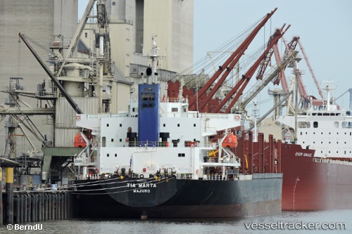
Vessel Tia Marta IMO: 9701243, MMSI: 538006538 Bulk Carrier
Live AIS position:
UTC. 42 nm SW of Bata),
updated 2025-12-20 11:48:34 UTC.
Find the position of the vessel Tia Marta on the map. The latter are known coordinates and path.
marine traffic ship tracker show on live map
The current position of vessel Tia Marta is 1.41644 lat / 9.22481 lng. Updated: 2025-12-20 11:48:34 UTCCurrently sailing under the flag of Marshall Is
Details:
Last coordinates of the vessel:
2025-12-20 11:48:34 UTC, 1.41644, 9.22481, course: -1, speed: 6.6