 vesseltracker.com
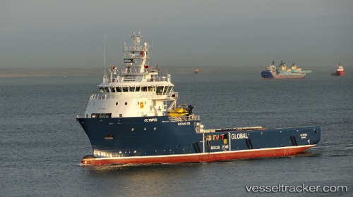
Vessel GRIP EXPLORER IMO: 9703526, MMSI: 257802000 Offshore Supply Ship
Live Vessel GRIP EXPLORER Analytics (details, animations, etc.)
Live AIS position: UTC. Near Puerto Montt), updated 2025-02-03 18:15:43 UTC.Find the position of the vessel GRIP EXPLORER on the map. The latter are known coordinates and path.
marine traffic ship tracker show on live map
The current position of vessel GRIP EXPLORER is -41.48475 lat / -72.95844 lng. Updated: 2025-02-03 18:15:43 UTCCurrently sailing under the flag of Norway (NIS)
GRIP EXPLORER built in 2014 year
Deadweight:
4000 tDetails:
Last coordinates of the vessel:
2025-02-03 18:15:43 UTC, -41.48475, -72.95844, course: 239, speed: 0