 vesseltracker.com
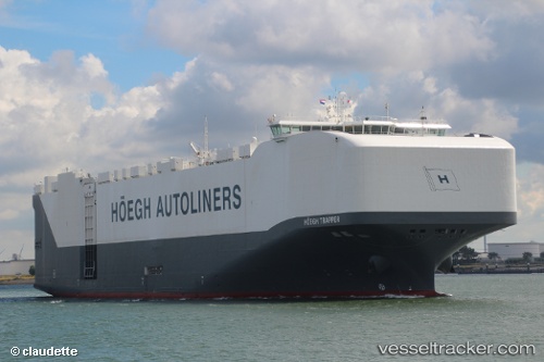
Vessel Hoegh Trapper IMO: 9706918, MMSI: 258872000 Vehicles Carrier
UTC, 30.19217, 146.53185, course: 304, speed: 16
UTC, 30.37017, 146.26569, course: 308, speed: 15.7
2026-02-11 13:55:51 UTC, 30.75100, 145.72116, course: 300, speed: 14.7
Live AIS position:
UTC. 288 nm NE of Omura),
updated 2026-02-11 13:55:51 UTC.
Find the position of the vessel Hoegh Trapper on the map. The latter are known coordinates and path.
marine traffic ship tracker show on live map
The current position of vessel Hoegh Trapper is 30.75100 lat / 145.72116 lng. Updated: 2026-02-11 13:55:51 UTCDetails:
Last coordinates of the vessel:
UTC, 29.77100, 147.14584, course: 305, speed: 16.8UTC, 30.19217, 146.53185, course: 304, speed: 16
UTC, 30.37017, 146.26569, course: 308, speed: 15.7
2026-02-11 13:55:51 UTC, 30.75100, 145.72116, course: 300, speed: 14.7