 vesseltracker.com
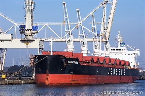
Vessel Sharpnes IMO: 9708928, MMSI: 371956000 Bulk Carrier
UTC, -38.13609, 131.72978, course: 102, speed: 11.4
UTC, -38.22680, 132.37740, course: 102, speed: 11.5
2026-02-14 04:19:27 UTC, -38.29500, 132.83833, course: -1, speed: 11
Live AIS position:
UTC. 260 nm SW of Port Lincoln),
updated 2026-02-14 04:19:27 UTC.
Find the position of the vessel Sharpnes on the map. The latter are known coordinates and path.
marine traffic ship tracker show on live map
The current position of vessel Sharpnes is -38.29500 lat / 132.83833 lng. Updated: 2026-02-14 04:19:27 UTCDetails:
Last coordinates of the vessel:
UTC, -38.05677, 131.15935, course: 99, speed: 11.6UTC, -38.13609, 131.72978, course: 102, speed: 11.4
UTC, -38.22680, 132.37740, course: 102, speed: 11.5
2026-02-14 04:19:27 UTC, -38.29500, 132.83833, course: -1, speed: 11