 vesseltracker.com
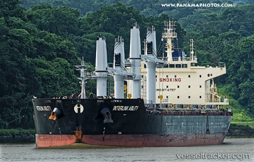
Vessel Interlink Ability IMO: 9714757, MMSI: 538005705 Bulk Carrier
UTC, 14.68333, 84.89833, course: -1, speed: 12
UTC, 14.57333, 84.86333, course: -1, speed: 11
2026-01-15 17:01:46 UTC, 14.25833, 84.74500, course: -1, speed: 11
Live AIS position:
UTC. 209 nm SE of Yanam),
updated 2026-01-15 17:01:46 UTC.
Find the position of the vessel Interlink Ability on the map. The latter are known coordinates and path.
marine traffic ship tracker show on live map
The current position of vessel Interlink Ability is 14.25833 lat / 84.74500 lng. Updated: 2026-01-15 17:01:46 UTCCurrently sailing under the flag of Marshall Is
Details:
Last coordinates of the vessel:
UTC, 14.75333, 84.92167, course: -1, speed: 12UTC, 14.68333, 84.89833, course: -1, speed: 12
UTC, 14.57333, 84.86333, course: -1, speed: 11
2026-01-15 17:01:46 UTC, 14.25833, 84.74500, course: -1, speed: 11