 vesseltracker.com
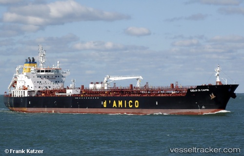
Vessel Cielo Di Capri IMO: 9717278, MMSI: 249435000 Oil Products Tanker
UTC, 51.36601, 2.70700, course: 80, speed: 8
UTC, 51.40620, 3.21699, course: 78, speed: 9.8
2026-03-19 09:35:06 UTC, 51.38534, 3.71569, course: 150, speed: 13.6
Live Vessel Cielo Di Capri Analytics (details, animations, etc.)
Live AIS position: UTC. Near Everingen), updated 2026-03-19 09:35:06 UTC.Find the position of the vessel Cielo Di Capri on the map. The latter are known coordinates and path.
marine traffic ship tracker show on live map
The current position of vessel Cielo Di Capri is 51.38534 lat / 3.71569 lng. Updated: 2026-03-19 09:35:06 UTCCurrently sailing under the flag of Malta
Details:
Last coordinates of the vessel:
UTC, 51.43057, 2.58489, course: 118, speed: 0.1UTC, 51.36601, 2.70700, course: 80, speed: 8
UTC, 51.40620, 3.21699, course: 78, speed: 9.8
2026-03-19 09:35:06 UTC, 51.38534, 3.71569, course: 150, speed: 13.6