 vesseltracker.com
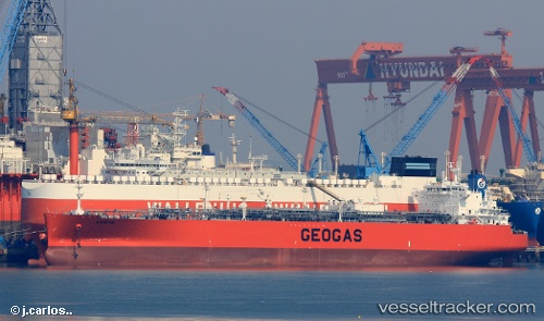
Vessel POINTIS IMO: 9719410, MMSI: 636021773 LPG Tanker
UTC, 29.68056, 32.62987, course: -1, speed: 0.1
UTC, 29.68074, 32.63100, course: -1, speed: 0
2026-03-25 04:03:08 UTC, 29.68128, 32.62857, course: -1, speed: 0
Live Vessel POINTIS Analytics (details, animations, etc.)
Live AIS position: UTC. Near Ras Sudr), updated 2026-03-25 04:03:08 UTC.Find the position of the vessel POINTIS on the map. The latter are known coordinates and path.
marine traffic ship tracker show on live map
The current position of vessel POINTIS is 29.68128 lat / 32.62857 lng. Updated: 2026-03-25 04:03:08 UTCCurrently sailing under the flag of Liberia
POINTIS built in 2016 year
Deadweight:
53991 tDetails:
Last coordinates of the vessel:
UTC, 29.68066, 32.63053, course: -1, speed: 0.1UTC, 29.68056, 32.62987, course: -1, speed: 0.1
UTC, 29.68074, 32.63100, course: -1, speed: 0
2026-03-25 04:03:08 UTC, 29.68128, 32.62857, course: -1, speed: 0