 vesseltracker.com
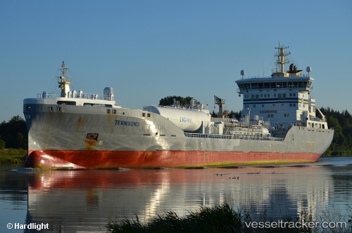
Vessel Ternsund IMO: 9722390, MMSI: 219775000 Chemical Oil Products Tanker
UTC, 55.32538, 14.54574, course: 38, speed: 14.4
UTC, 55.56564, 15.20722, course: 62, speed: 14.3
2026-02-10 08:19:51 UTC, 55.88724, 16.18332, course: 60, speed: 15.3
Live AIS position:
UTC. 26 nm SE of Karlskrona),
updated 2026-02-10 08:19:51 UTC.
Find the position of the vessel Ternsund on the map. The latter are known coordinates and path.
marine traffic ship tracker show on live map
The current position of vessel Ternsund is 55.88724 lat / 16.18332 lng. Updated: 2026-02-10 08:19:51 UTCCurrently sailing under the flag of Denmark
Details:
Last coordinates of the vessel:
UTC, 54.95454, 13.81122, course: 74, speed: 14.4UTC, 55.32538, 14.54574, course: 38, speed: 14.4
UTC, 55.56564, 15.20722, course: 62, speed: 14.3
2026-02-10 08:19:51 UTC, 55.88724, 16.18332, course: 60, speed: 15.3