 vesseltracker.com
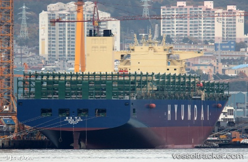
HYUNDAI EARTH
Current StatusLive Vessel HYUNDAI EARTH Analytics (details, animations, etc.)
Where is the vessel?
HYUNDAI EARTH is currently in Near Savannah, based on AIS data received about 1h ago.
Latest AIS update:
Current position: 32.13176° N, 81.14144° W (Near Savannah)
Vessel profile: HYUNDAI EARTH is a Container Ship with dimensions 324m x 48m.
This page combines live AIS, route history, probable destination signals, nearby traffic, and port activity for practical vessel monitoring.
The current position of vessel HYUNDAI EARTH is 32.13176 lat / -81.14144 lng. Updated: 2026-03-25 06:24:43 UTCNearest reference points:
- Near Saint Andrews
- Near Brunswick
- 33 nm S of Kiawah Island
Currently sailing under the flag of United Kingdom
HYUNDAI EARTH built in 2016 year
Deadweight:
124092 tDetails:
Last coordinates of the vessel:
2026-03-25 00:22:28 UTC, 31.94054, -80.66647, course: 295, speed: 4.42026-03-25 01:51:29 UTC, 32.05893, -80.94369, course: 320, speed: 13.3
2026-03-25 04:15:43 UTC, 32.13177, -81.14142, course: 320, speed: 0.1
2026-03-25 06:24:43 UTC, 32.13176, -81.14144, course: 320, speed: 0