 vesseltracker.com
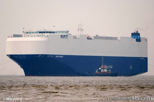
Vessel Viking Conquest IMO: 9728851, MMSI: 566971000 Vehicles Carrier
UTC, 34.50727, 139.03282, course: 240, speed: 15.6
UTC, 34.28108, 138.48045, course: 258, speed: 15.2
2026-02-16 16:19:55 UTC, 34.05858, 137.96672, course: 247, speed: 15.5
Live AIS position:
UTC. 36 nm S of OMAEZAKI),
updated 2026-02-16 16:19:55 UTC.
Find the position of the vessel Viking Conquest on the map. The latter are known coordinates and path.
marine traffic ship tracker show on live map
The current position of vessel Viking Conquest is 34.05858 lat / 137.96672 lng. Updated: 2026-02-16 16:19:55 UTCDetails:
Last coordinates of the vessel:
UTC, 34.87182, 139.63399, course: 184, speed: 17UTC, 34.50727, 139.03282, course: 240, speed: 15.6
UTC, 34.28108, 138.48045, course: 258, speed: 15.2
2026-02-16 16:19:55 UTC, 34.05858, 137.96672, course: 247, speed: 15.5