 vesseltracker.com
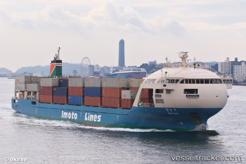
Vessel Natori IMO: 9729788, MMSI: 431007132 Container Ship
UTC, 32.67093, 132.99548, course: 269, speed: 14.2
UTC, 32.66562, 132.69147, course: 267, speed: 15.5
2026-02-09 23:19:17 UTC, 32.41665, 132.31995, course: 224, speed: 14.3
Live AIS position:
UTC. 32 nm E of Hososima Ko),
updated 2026-02-09 23:19:17 UTC.
Find the position of the vessel Natori on the map. The latter are known coordinates and path.
marine traffic ship tracker show on live map
The current position of vessel Natori is 32.41665 lat / 132.31995 lng. Updated: 2026-02-09 23:19:17 UTCCurrently sailing under the flag of Japan
Details:
Last coordinates of the vessel:
UTC, 32.98649, 133.70847, course: 241, speed: 16.9UTC, 32.67093, 132.99548, course: 269, speed: 14.2
UTC, 32.66562, 132.69147, course: 267, speed: 15.5
2026-02-09 23:19:17 UTC, 32.41665, 132.31995, course: 224, speed: 14.3