 vesseltracker.com
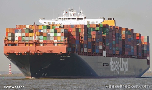
Vessel AL JMELIYAH IMO: 9732357, MMSI: 211886490 Cargo A
UTC, -14.72258, 61.87098, course: 43, speed: 17.6
UTC, -14.32507, 62.21423, course: 43, speed: 17.6
2026-03-24 23:38:29 UTC, -13.84429, 62.61786, course: 45, speed: 17.7
Live Vessel AL JMELIYAH Analytics (details, animations, etc.)
Live AIS position: UTC. 354 nm N of Port Mathurin), updated 2026-03-24 23:38:29 UTC.Find the position of the vessel AL JMELIYAH on the map. The latter are known coordinates and path.
marine traffic ship tracker show on live map
The current position of vessel AL JMELIYAH is -13.84429 lat / 62.61786 lng. Updated: 2026-03-24 23:38:29 UTCCurrently sailing under the flag of Germany
Details:
Last coordinates of the vessel:
UTC, -15.04569, 61.59317, course: 44, speed: 17UTC, -14.72258, 61.87098, course: 43, speed: 17.6
UTC, -14.32507, 62.21423, course: 43, speed: 17.6
2026-03-24 23:38:29 UTC, -13.84429, 62.61786, course: 45, speed: 17.7