 vesseltracker.com
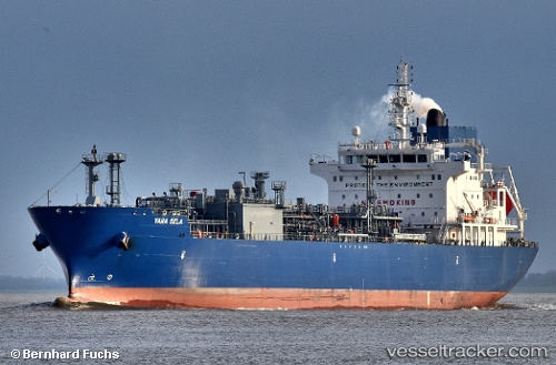
Vessel Yara Sela IMO: 9734850, MMSI: 258936000 Lpg Tanker
UTC, 42.19500, -29.73500, course: -1, speed: 13
UTC, 42.01667, -30.28333, course: -1, speed: 14
2026-03-24 21:37:40 UTC, 41.81154, -30.92075, course: 250, speed: 14.1
Live Vessel Yara Sela Analytics (details, animations, etc.)
Live AIS position: UTC. 79 nm E of Langa de Duero), updated 2026-03-24 21:37:40 UTC.Find the position of the vessel Yara Sela on the map. The latter are known coordinates and path.
marine traffic ship tracker show on live map
The current position of vessel Yara Sela is 41.81154 lat / -30.92075 lng. Updated: 2026-03-24 21:37:40 UTCDetails:
Last coordinates of the vessel:
UTC, 42.38333, -29.13833, course: -1, speed: 12UTC, 42.19500, -29.73500, course: -1, speed: 13
UTC, 42.01667, -30.28333, course: -1, speed: 14
2026-03-24 21:37:40 UTC, 41.81154, -30.92075, course: 250, speed: 14.1