 vesseltracker.com
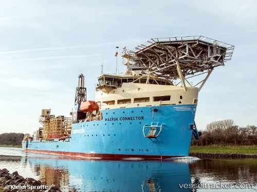
 Maersk Connector
Current Status
Where is the vessel?
Maersk Connector is currently in 19 nm NW of MAILIAO, based on AIS data received about 3h ago.
Latest AIS update:
Current position: 24.05333° N, 119.97333° E (19 nm NW of MAILIAO)
Average speed (last 7 days): Loading…
Average speed (last 30 days): Loading…
Vessel profile: Maersk Connector is a Cable Layer with dimensions 138m x 28m.
This page combines live AIS, route history, probable destination signals, nearby traffic, and port activity for practical vessel monitoring.
The current position of vessel Maersk Connector is 24.05333 lat / 119.97333 lng. Updated: 2026-03-26 03:26:09 UTCNearest reference points:
- Near MAILIAO
- 13 nm N of MAGONG
- Near Tai-tung Kang
Currently sailing under the flag of Denmark ![]()
Details:
Live Vessel Maersk Connector Analytics (details, animations, etc.)
Recent AIS points (UTC):
2026-03-25 22:23:19 UTC · 24.12970, 120.28079 · SOG 0.1 kn · COG 27°2026-03-25 23:26:00 UTC · 24.12965, 120.28087 · SOG 0.2 kn · COG 23°
2026-03-26 01:48:59 UTC · 24.19638, 120.12829 · SOG 8.7 kn · COG 238°
2026-03-26 03:26:09 UTC · 24.05333, 119.97333 · SOG 8 kn · COG -1°