 vesseltracker.com
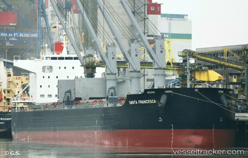
 Santa Francesca
Current Status
Where is the vessel?
Santa Francesca is currently in Near Alexandria, based on AIS data received about 2h ago.
Latest AIS update:
Current position: 31.17257° N, 29.86260° E (Near Alexandria)
Average speed (last 7 days): Loading…
Average speed (last 30 days): Loading…
Vessel profile: Santa Francesca is a Bulk Carrier with dimensions 200m x 32m.
This page combines live AIS, route history, probable destination signals, nearby traffic, and port activity for practical vessel monitoring.
The current position of vessel Santa Francesca is 31.17257 lat / 29.86260 lng. Updated: 2026-03-25 12:21:38 UTCNearest reference points:
- Near Alexandria
- Near EL DEKHEILA
- 13 nm W of EL DEKHEILA
Currently sailing under the flag of Marshall Is ![]()
Details:
Live Vessel Santa Francesca Analytics (details, animations, etc.)
Recent AIS points (UTC):
2026-03-25 06:00:35 UTC · 31.17260, 29.86198 · SOG 0.1 kn · COG 319°2026-03-25 08:09:37 UTC · 31.17311, 29.86231 · SOG 0.1 kn · COG 305°
2026-03-25 09:54:49 UTC · 31.17288, 29.86243 · SOG 0 kn · COG 305°
2026-03-25 12:21:38 UTC · 31.17257, 29.86260 · SOG 0 kn · COG 308°