 vesseltracker.com
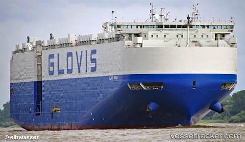
Vessel Glovis Sirius IMO: 9749582, MMSI: 538006791 Vehicles Carrier
UTC, 26.27033, 51.79667, course: 222, speed: 7
UTC, 26.27033, 51.79667, course: 222, speed: 7
2026-02-21 02:47:02 UTC, 26.27033, 51.79667, course: 222, speed: 7
Live AIS position:
UTC. 22 nm SW of Al Shaheen terminal),
updated 2026-02-21 02:47:02 UTC.
Find the position of the vessel Glovis Sirius on the map. The latter are known coordinates and path.
marine traffic ship tracker show on live map
The current position of vessel Glovis Sirius is 26.27033 lat / 51.79667 lng. Updated: 2026-02-21 02:47:02 UTCDetails:
Last coordinates of the vessel:
UTC, 26.66981, 51.89935, course: 316, speed: 0.6UTC, 26.27033, 51.79667, course: 222, speed: 7
UTC, 26.27033, 51.79667, course: 222, speed: 7
2026-02-21 02:47:02 UTC, 26.27033, 51.79667, course: 222, speed: 7